Imagen principal
Dirección
Cerro de Santa Bárbara
Galería de imágenes
Categoría
Ubicación
42.06687, -1.6067
Descripción corta
"Cata sector 7" and "Sector of the Wells"
Descripción larga
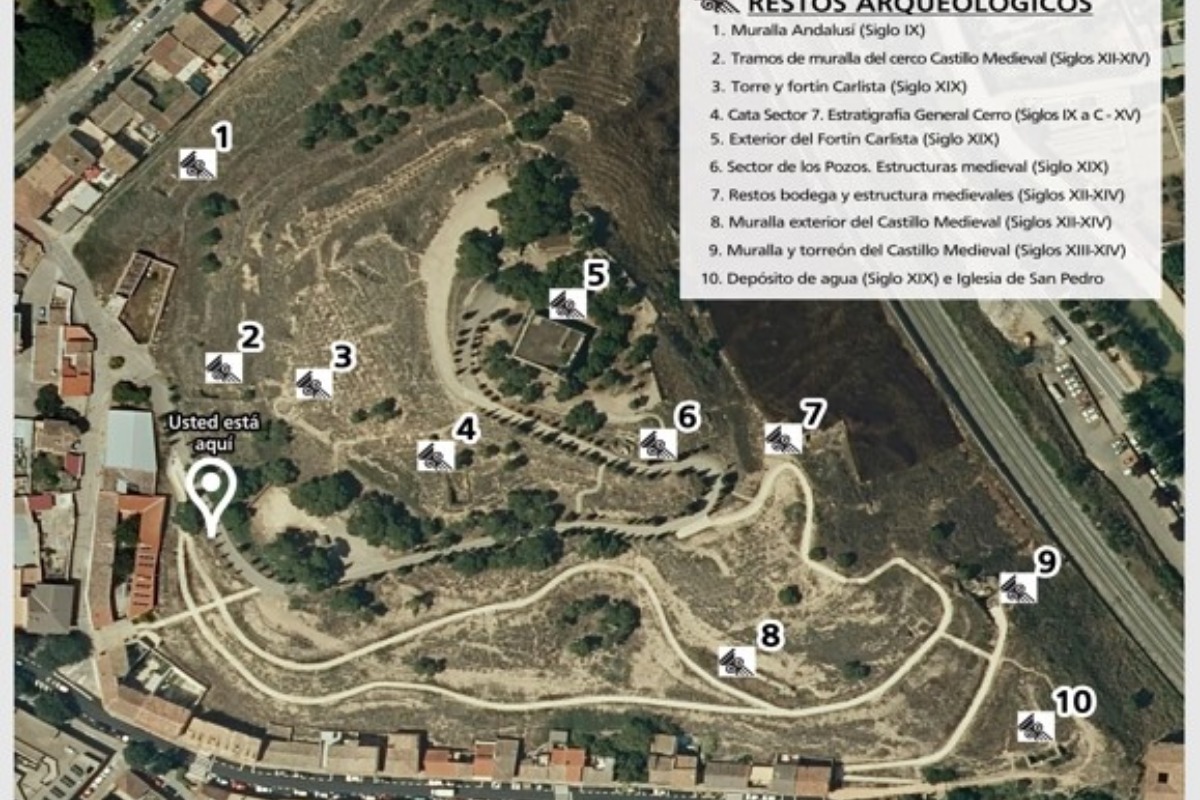
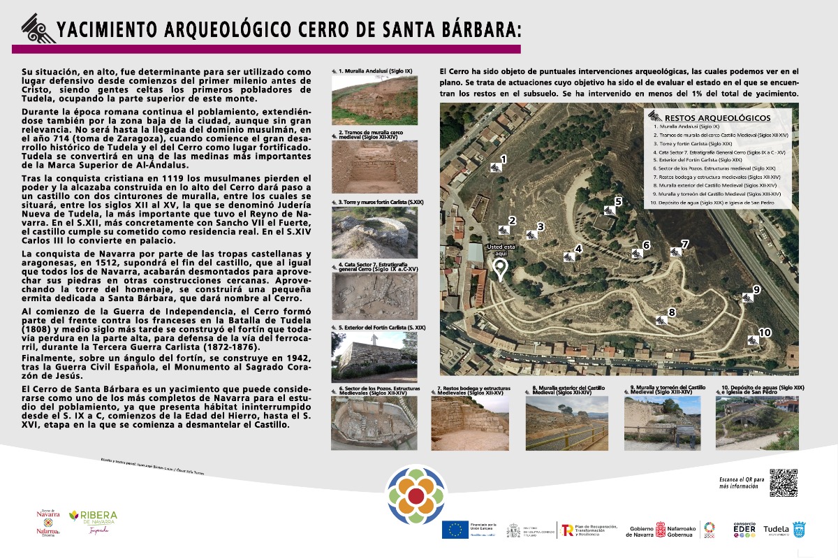
The two areas are located on the southern slope of Santa Bárbara Hill, considered one of the most important archaeological sites in Navarre, declared a Cultural Heritage Site (BIC) and containing remains and structures from the beginning of the first millennium BC to the Carlist Wars.
The two areas correspond to archaeological projects carried out in different years.
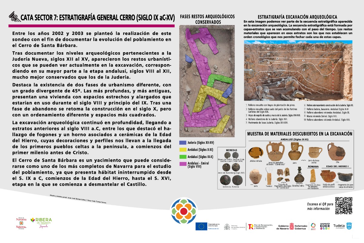
Specifically, the so-called "Sector 7" excavation was carried out in 2002–2003. It measures 10 x 5 m and is located on a large terrace that formed part of the parade grounds of the fort built for the Third Carlist War. Its excavation revealed urban remains from the New Jewish Quarter (12th–15th centuries), urban remains from two phases corresponding to the Andalusian Tudela period (8th–12th centuries), and occupation levels from the First Iron Age (9th–4th centuries BC).
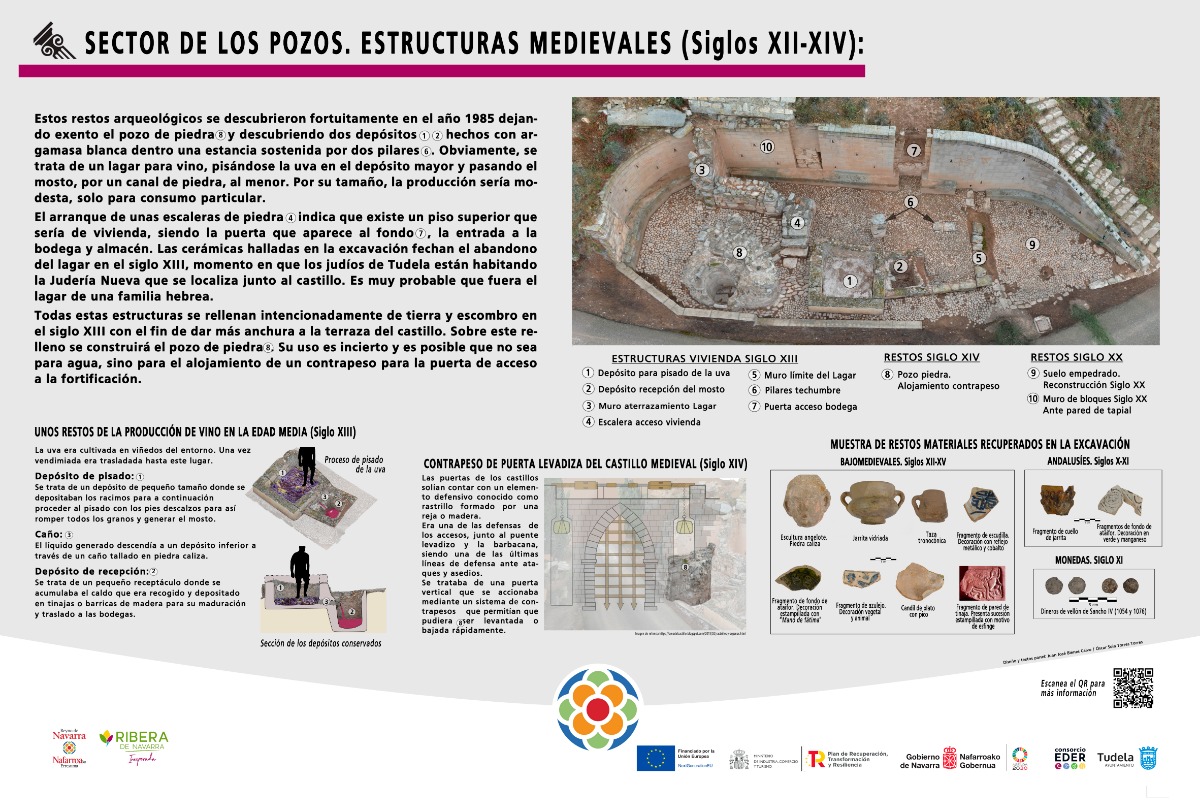
The other area, called the "Wells Sector," was excavated in 1985 and is located on one side of the road that leads up to the top of the hill. It consists of several structures, including two quadrangular tanks for treading grapes and collecting must, as well as the bottom of a stone well that originated at a higher elevation than the one preserved today. The tank structures were abandoned in the early 13th century, while the stone well was built around that time. After its discovery, the area suffered looting and vandalism, with some of the structures collapsing and pieces of attached columns being stolen. A few years later, some walls were strengthened and river pebble floors were laid.
The two areas correspond to archaeological projects carried out in different years.
Specifically, the so-called "Sector 7" excavation was carried out in 2002–2003. It measures 10 x 5 m and is located on a large terrace that formed part of the parade grounds of the fort built for the Third Carlist War. Its excavation revealed urban remains from the New Jewish Quarter (12th–15th centuries), urban remains from two phases corresponding to the Andalusian Tudela period (8th–12th centuries), and occupation levels from the First Iron Age (9th–4th centuries BC).
The other area, called the "Wells Sector," was excavated in 1985 and is located on one side of the road that leads up to the top of the hill. It consists of several structures, including two quadrangular tanks for treading grapes and collecting must, as well as the bottom of a stone well that originated at a higher elevation than the one preserved today. The tank structures were abandoned in the early 13th century, while the stone well was built around that time. After its discovery, the area suffered looting and vandalism, with some of the structures collapsing and pieces of attached columns being stolen. A few years later, some walls were strengthened and river pebble floors were laid.
Destacado
Desactivado