Imagen principal
Distancia
40.53
Desnivel positivo
273.00
Desnivel negativo
273.00
Altitud máxima
433.00
Altitud mínima
256.00
Galería de imágenes
Archivo KML
pr-na-211.kml (196.35 KB)
Ubicacion donde empieza la ruta
42.066149730729, -1.603290438652
Horas de recorrido
5
Minutos de recorrido
30
Tipo de ruta
Tipo de circuito
Dificultad técnica
Descripción corta
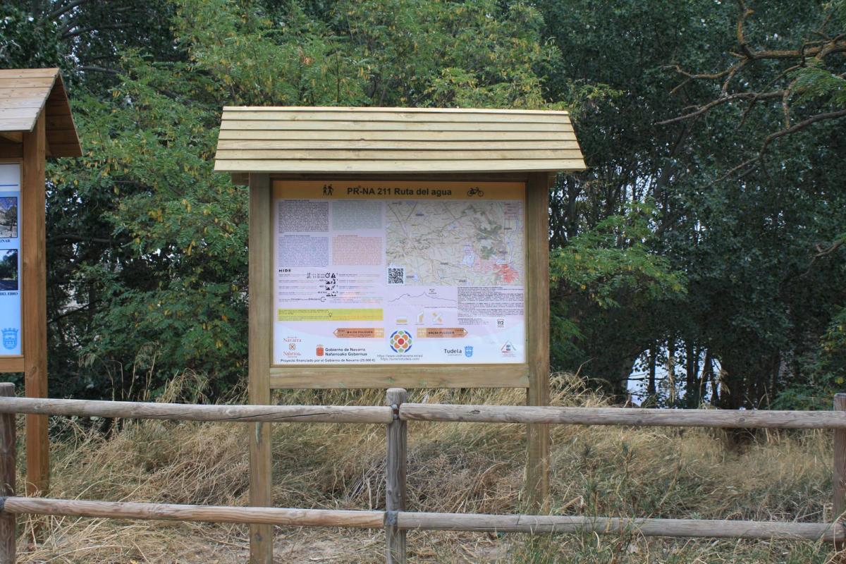
The route is signposted for use in either direction.
Descripción larga
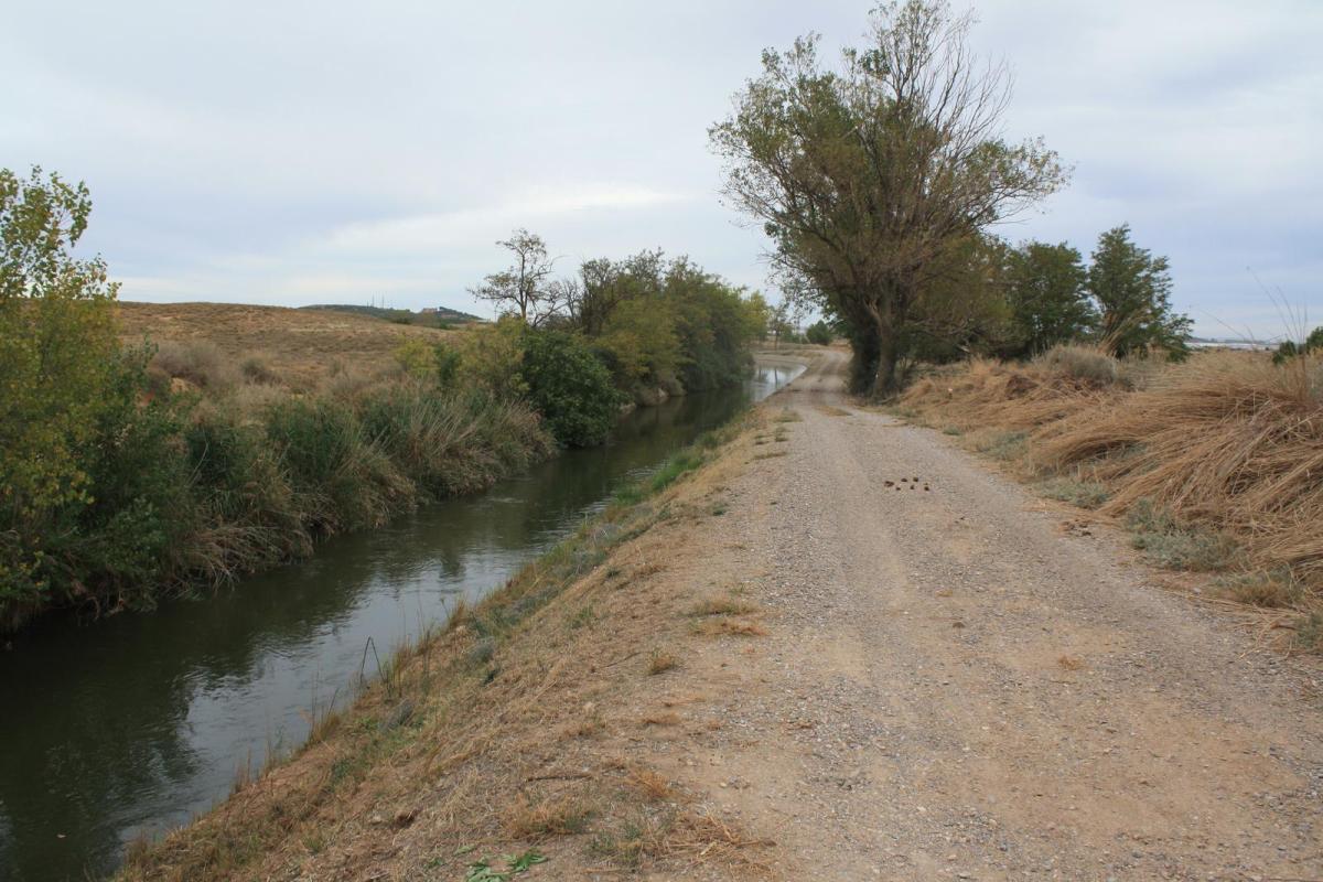
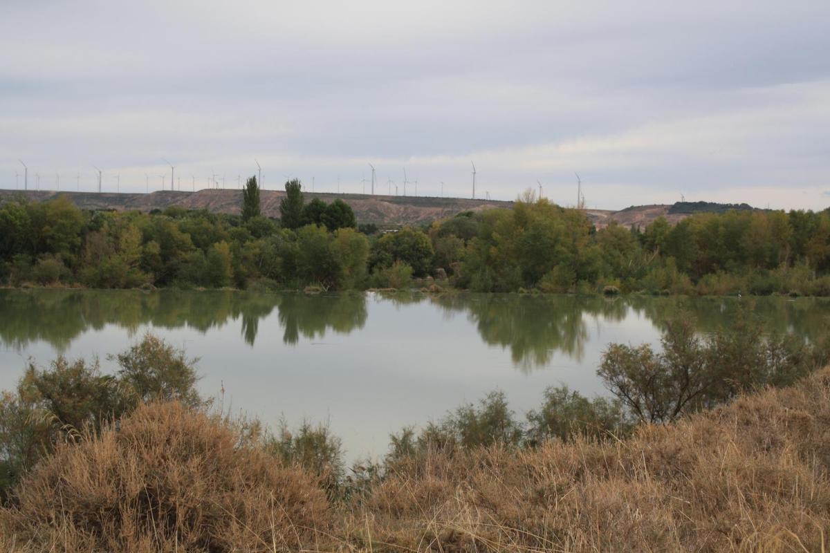
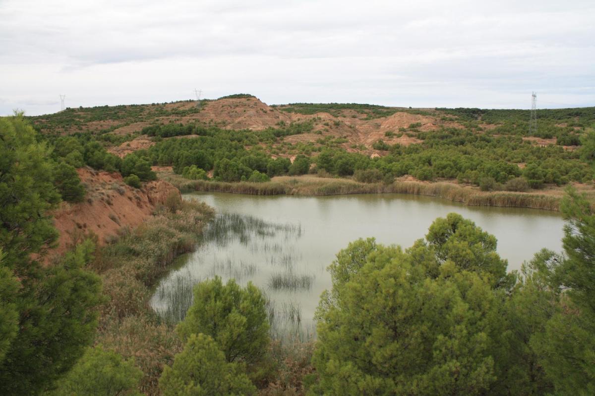
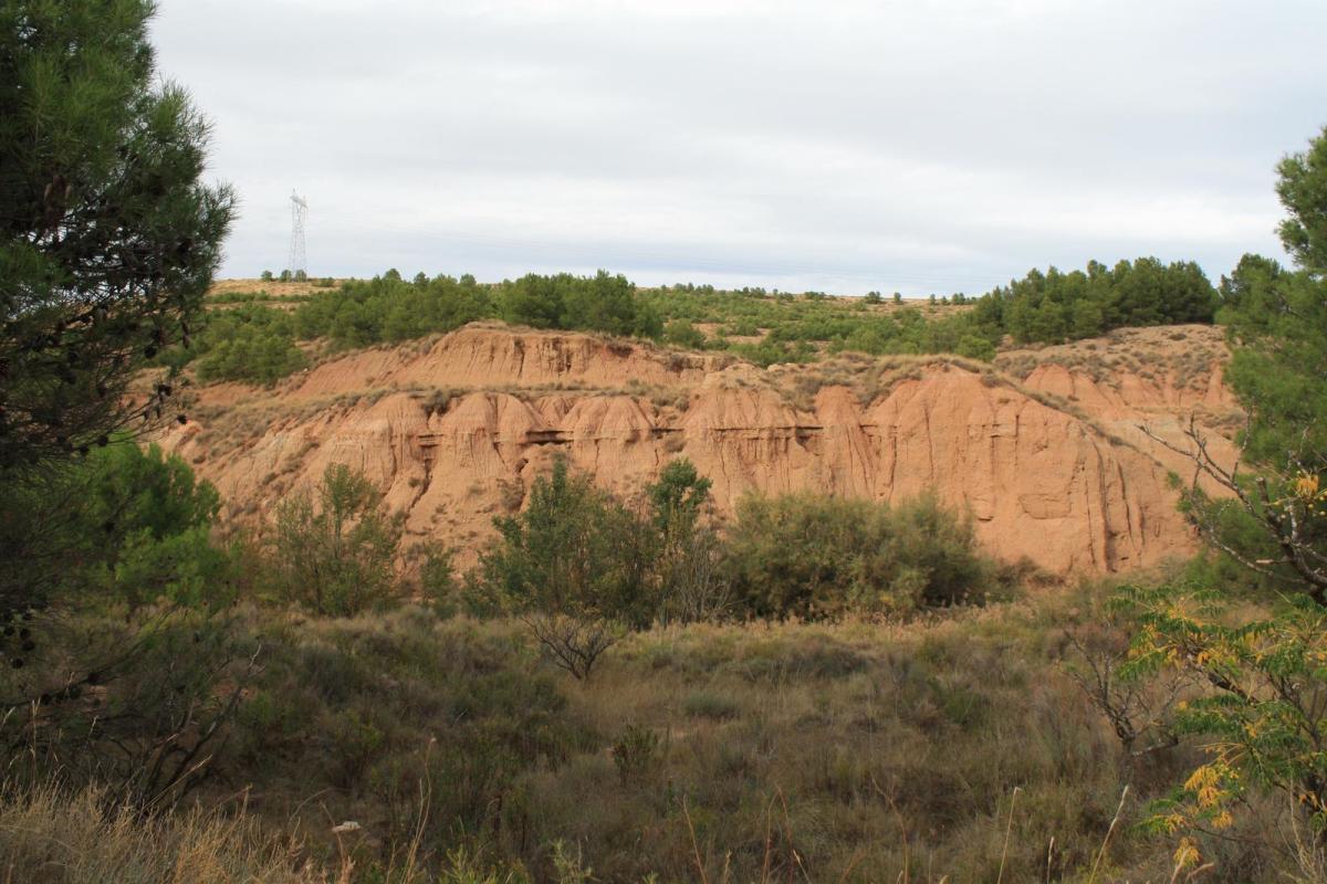
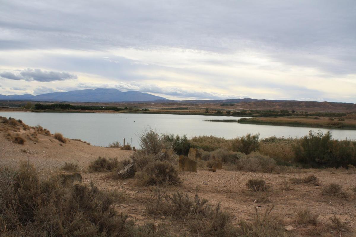
Starting next to the great Ebro bridge (12th century) and crossing the Mejana, we can approach the Soto de los Tetones to contemplate its flora and fauna from its observatory. Returning, we ascend the Barcelosa ravine, which gives its name to this area. The route passes through pine forests and low scrubland (thyme, rosemary, etc.), later changing to a large steppe area. We pass the ruins of the Hermitage of San Marcos. Between cereal farms, we arrive at the Salt Water Pools, which we walk around, admiring their plant heritage and inhabitants. Passing by the Montes de Cierzo wind farm, we arrive at the Balsa del Pulguer oasis, where we can take a dip in summer or observe its waterfowl at any time of year. Next to the Lodosa canal, we reach another haven of life, the Cardete pond. We'll enter the town center of Tudela via the Paseo de Ronda de Santa Quiteria and, after crossing the Queiles River, we'll stroll along the Paseo de los Poetas, parallel to the beautiful Queiles Park. Passing under the arches of the Clock House, we'll reach the Plaza de los Fueros with its bandstand. Leaving the town center and reaching the Ebro Bridge, we'll arrive at the start of the route at the Puerta de la Mejana.
Vídeo
TextInMotion-VideoSample-576p_5.mp4 (12.51 MB)
Enlace
https://es.wikiloc.com/rutas-mountain-bike/pr-na-211-117252710
Destacado
Desactivado